edAfter my first successful try today, I thought I'd write a little tutorial for creating landscapes. Here are some (hopefully) simple steps:
3. Delete the sky from the image. Stellarium looks for 'blank' locations in the image when it decides where the scenery ends and the sky begins, so you need to erase the actual sky from the photo. I used paint.net to select the sky in my panorama, and then pressed 'delete' to get rid of it, exposing the checkered canvas behind. You cannot just paint over it in MS Paint, you actually need to remove it from the canvas. To add extra effect, you can delete the pixels in subtle areas (between tree branches, through windows, etc...) to produce a realistic horizon.
4. Create your landscape folder. You need to add a new folder to the Program Files --- Stellarium --- landscapes directory (its name does not matter). Then, create a next file called 'landscape.ini' (you can copy and paste this from another landscape folder and erase its contents) and copy your panorama to the same folder.


Mémorial de la Ferme de Richemont, Saucauts, France
Rubeluta Valentin
CC BY-NC-SA 3.0
0.10.x
English
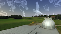
Observation site at 25 Km from Bordeaux - France (a fine mask of light has been added to N where the city is). This place is located at 44.62 N 0.63 E and it is the observation place of the astronomy club: AG33. This landscape is 4096 pixels wide and file size is about 25 MB. The 2048 pixels version - 6.7 MB, can be downloaded here.
Épendes Observatory, Fribourg, Switzerland
Nicolas Martignoni
CC BY-NC-SA 3.0
0.10.x
English
The Épendes Observatory (46°45′45″N 7°08′22″E) is located near the city of Fribourg, Switzerland. The images for this landscape were taken in August 2006. The landscape comes in three resolutions (1024 / 2048 / 4096). File size is about 2.4 MB.
Note: If you have problems with this landscape (landscape doesn't appear because of low memory on the graphic chip), use the corresponding old style landscape below or use a smaller resolution (see the README file in the package).

Épendes Observatory, Fribourg, Switzerland
Nicolas Martignoni
CC BY-NC-SA 3.0
0.10.x
English
The Épendes Observatory (46°45′45″N 7°08′22″E) is located near the city of Fribourg, Switzerland. The images for this landscape were taken in August 2006. This landscape (old style format) is intended to be used on older configurations, where spherical landscape (above) doesn't appear because of low memory on the graphic chip. File size is about 2.4 MB.

Kuffner Observatory, Vienna, Austria
Michael Prokosch
CC BY-ND 3.0
0.9.x
English
A view from the outskirts of Vienna. Moriz Edler von Kuffner's observatory (48°12'48"N 16°23'48"E) was built in the 1880s in todays 16th district of Vienna. The pictures on the wall were added to acknowledge it's rich history, including the still largest heliometer worldwide. This landscape was created in late summer 2013. File size is roughly 15.6 MB.

Urania Observatory, Vienna, Austria
Michael Prokosch
CC BY-ND 3.0
0.9.x
English
The Urania Observatory (48°12′41.88″N 16°23′1.53″E) is located right in the middle of the city of Vienna, capital of Austria. Built in 1910 under emporer Franz Joseph I. it's the countries oldest non-scientifical observatory still in use for people's education. This landscape was taken in August 2011. If you are not distracted by the stars, you can even see St. Stephan's cathedral, the Viennese Giant Wheel and the Danube Canal. File size is about 11.5 MB.

Port of La Guardia, Galicia, Spain
Quiero Regresar a mi Planeta
CC BY-NC-ND 3.0
0.10.x
English
La Guardia is a fishing village in Galicia, in the NW. of Spain. This landscape was taken on the 19/07/2008. KMZ file.

Castle of Castro Laboreiro 13th Century, Melgaço, Portugal
Quiero Regresar a mi Planeta
CC BY-NC-ND 3.0
0.10.x
English
Castro Laboreiro is a village in Melgaço, in the NW. of Portugal. This landscape was taken on the 15/08/2010. Kmz file.

Jungfraujoch High Altitude Research Station, Switzerland
Christian Waldvogel
N/A
0.10.x
English
Lying at 3580m in the Bernese Alps, the Jungfraujoch is often dubbed "Top of Europe". It has been home to an astronomical observation station for more than 80 years. The spherical landscape was created from 20 images taken on June 29th, 2008, at 1015, from the lower terrace of the Sphinx Obervatory. The landscape comes in three resolutions (1024 / 2048 / 4096).

St Peter's Square (Vatican)
Gianfranco Mazzani
N/A
0.10.x
English
This is a complete high resolution panoramic view of the St Peter's Square, City of Vatican.
Gianfranco Mazzani photographed this panorama in july 2004 by using a Nikon Coolpix 8700, and stitched the original 10 pictures together into a spherical panorama using Hugin program. The panorama has been than cutted into 8 alfa channel pictures and re-dimensioned the width to 2048 pixel and then dimensioned the height to 32 cm by using Photoschop elements 2.

Frantoio Rodiano, Italy
Christian Waldvogel
N/A
0.10.x
English
The Frantoio Rodiano (Rodiano oil press) is situated on the foot of Mount Gargano in Puglia / Italy. Just a few kilometers uphill lies Monte Sant'Angelo, the famous stop for christian pilgrims on their way to Jerusalem. Stargazing has been kin to this region for milleniae: the oldest graves found in the Frantoio's vicinity date back to pre-etruscan times, and the famous Castel del Monte, an astronomical observation in itself, is not far either. The spherical landscape was created from 8 images taken on September 20th, 2010, at 1707, from the uppermost terrace of the Frantoio Rodiano. The landscape comes in three resolutions (1024 / 2048 / 4096).

Roque de los Muchachos, La Palma, Spain
Uwe Buecher
N/A
0.10.x
English
This high resolution landscape was built with hugin from 20 photos taken in October 2007. It is located on top of the highest mountain on La Palma, Canary Islands. You can see the Buildings of the Observatorio del Roque de los Muchachos, one of them is the Gran Telescopio Canarias (GTC) which is the greatest telescope in the world today (10.4m diameter).

English Garden, Munich, Germany
Rob Spearman, Johan Meuris
N/A
0.9.x
English
This high resolution landscape was taken in April 2007 by Rob. Johan helped with the post production. The result is a very high quality landscape.
English Garden, Munich, Germany
Rob Spearman, Johan Meuris
N/A
0.9.x
English
The original English Garden landscape was re-constructed by Barry Gerdes as an old_style landscape. This means that it can be used with video hardware which cannot cope with single very large texture files, and yet preserves the resolution of the landscape (by splitting the images into multiple files). Try this is the original English Garden landscapes doesn't load on your computer.

Drei Schwestern, Fürstentum Liechtenstein
Marcel Marxer
GNU GPL
0.10.x
English
This landscape was taken from the the peak of Drei Schwestern, a mountain top in Liechtenstein. The view includes parts of Switzerland, Liechtenstein, Austria and beyond Lake Constance (Bodensee) even a piece of Germany. File size is about 2.2 MB.

Voksenlia, Oslo, Norway
Steinar Midtskogen
N/A
0.10.x
English
Steinar Midtskogen sent this huge (17 MiB!) spherical landscape image of Voksenlia, Oslo, Norway (59°58'14N, 10°38'57E, alt=348m). (Currently not working with version 0.9.0).

Calton Hill, Edinburgh, Scotland
Friedrich Noelle, Barry Gerdes
N/A
0.9.x
English
Friedrich Noelle took a nice panorama of Observatory Hill, Edinburgh which Barry converted into a Stellarium landscape.

Sighthill stone circle, Glasgow, Scotland
Grahame Gardner
N/A
0.9.x
English
Sighthill stone circle is a modern stone ring constructed in 1979 by amateur astronomer and SF writer Duncan Lunan. Located next to the M8 motorway in Glasgow city centre, yet with surprisingly good views, the circle has alignments to the solsticial solar rises and settings and the lunar standstills. Alignments to the rising of Rigel are included for 1979 AD and 1800 BC. (2MB)

Beech Hill stone circle, nr. Nutley, E. Sussex, England
Grahame Gardner
N/A
0.9.x
English
Beech Hill is a modern stone ring constructed in 2000 by Ivan McBeth and Richard Creightmore of The Geomancy Group www.geomancygroup.org. Located in the Ashdown Forest, the circle's main alignment is to the Pole Star, denoted by the angled outlier. (2.2MB)

Calanais I (Callanish) Avenue, Lewis, Western Isles, Scotland
Grahame Gardner
N/A
0.9.x
English
Callanish is arguably the finest megalithic monument in the British Isles, and is just the largest site in a vast complex of interconnected monuments designed to observe the southern major standstills of the moon. From this position at the end of the avenue, the moon is seen to set behind the rocky outcrop of Cnoc-an-Tursa, only to 're-gleam' in the centre of the main circle a short time afterwards. (4MB)

Machrie Moor 5, Isle of Arran, Scotland
Grahame Gardner
N/A
0.9.x
English
This delightful little double-concentric stone circle is the first site you come to when visiting the Machrie Moor complex of megalithic sites on Arran. Although not the most spectactular site in the group, it is one of the most complete and has good views. (7.3MB)

Mitchell's Fold stone circle, Shropshire, England
Ian Pegler
N/A
0.9.x
English
This wonderful ancient stone circle stands on a plateau amid the rolling Shropshire hills and is loved by walkers, dowsers and Wiccans alike. April 2010 - new version uploaded, featuring improved centre camera position based on Alexander Thom's geometry and improved alignments. (1.8MB)

Avebury - North circle, Wiltshire, England
Ian Pegler
N/A
0.9.x
English
The North circle of the largest megalithic complex in Europe. In the background you can just make out the Red Lion pub. (1MB)

Glastonbury Tor, Somerset, England
Ian Pegler
N/A
0.9.x
English
The Tor with its iconic Tower of St. Michael is one of the most recognisable landmarks in England. At the cross-quarter day nearest the Celtic festival of Samhain (early November time) the Sun sets as it passes by the doorway of the tower.
The famous St. Michael ley-line runs through here. (3.6MB)

Valle Crucis Abbey, Llangollen, North Wales
Ian Pegler
N/A
0.9.x
English
This ruined Cistercian abbey dates to 1200 but may be the site of a much earlier Dark Age settlement with a very early Christian church. (2.5MB)

Ponta da Piedade, Algarve, Lagos, Portugal
Johan
N/A
0.9.x
English
Johan photographed this panorama in June 2006 and stitched it together into a spherical panorama that can be used with Stellarium. You see sandstone cliffs on the Atlantic coast of southern Portugal, a lighthouse, and a natural bridge.

Gurnigel, Switzerland
Martin Mutti
N/A
0.9.x
English
This is the site of the Bern Astronomical Society's observing site.

Tishinka, Russia
Dmitri Ardashev
N/A
0.9.x
English
This is a small village between Moscow's and Kaluga's regions, in 130 km south-west of Moscow (55°18'32.46N, 36°26'42.06E, alt=195).

T60 dome, Pic du Midi Observatory, France
Sylvain Rondi
N/A
0.9.x
English
Sylvain photographed this panorama in February 2007 and stitched it together into a spherical panorama that can be used with Stellarium. This is the panoramic view from the amateur 60cm telescope dome from T60 Association, installed at Pic du Midi Observatory.

T1M terrasse, Pic du Midi Observatory, France
Sylvain Rondi
N/A
0.9.x
English
Sylvain photographed this panorama in February 2007 and stitched it together into a spherical panorama that can be used with Stellarium. This is the panoramic view from the terrasse of the professional 106cm telescope at Pic du Midi Observatory (France).

River Rivelin, Sheffield, UK
Jan Wedekind
CC SA-2.0
0.9.x
English
This is a 270° fisheye panorama created from 40 photos using Hugin. It shows the River Rivelin in Sheffield in the middle of April 2007. The fringes (twigs and tree tops) where dimmed out using The Gimp. The overexposed parts of the horizon have been removed. Copyright (C) 2007, Jan Wedekind, Creative Commons Attribution ShareAlike License 2.0

Ares, Galicia, Spain
Rubén Castiñeiras Lorenzo
N/A
0.9.x
English
Ares is a small fishing village in Galicia, in the NW of Spain, close to the city of Ferrol. The 360 degree image was taken at the noon of August 6th, 2007, just in front of the "Paseo Rosalía de Castro". It has been made with 17 photos, stitched with Hugin 0.7 beta 4 and retouched with the Gimp 2.2.17.

Ovindoli, Italy
Pierluigi Panunzi
N/A
0.9.x
English
Ovindoli is a famous ski resort in central Italy.

Rustrel, France
Xavier Bonnefoy-Cudraz
N/A
0.9.x
English
This is a panoramic view of the Colorado de Rustrel in "Les Sentiers de l'Ocre et du Fer", Provence, France.

Stintino, Italy
aid85
N/A
0.9.x
English
High resolution 360° landscape taken at "LaPelosa" beach in Stintino (SS) Sardinia \ Italy - Europe \ Mediterranean Sea.

St Peter's Square, Vatican
Xavier Bonnefoy-Cudraz
N/A
0.9.x
English
This is a panoramic view of the St Peter's Square. City of Vatican. Some parts of the buildings are missing, not enough pictures... This site is part of UNESCO World Heritage.

Munegu, MC
aid85
N/A
0.9.x
English
High resolution 360° landscape taken at Larvotto beach in Munegu \ Monaco - MC (MonteCarlo) - Europe \ Mediterraneum Sea - Ligurian Sea.

Bahia de Cádiz, Spain
José Codejón
N/A
0.10.x
English
A new bridge is being built across de bay. The 360° panorama image was taken at noon of September 10th, 2012, from the pier of the small marina just closed to the Cadiz head of the bridge.
The final picture is the result of stitching 11 frames, taken out of a 63 seconds full HD video, using PhotoStitch and Gimp 2.6.8.

Cocentaina, Spain
Angel Juan Martínez
N/A
0.9.x
English
This is a panoramic view from the roof of the Secondary School of Cocentaina, a little town of the Pais Valencià (Spain), in the mountains that are between Valencia and Alicante, where I teach Astronomy with the help of Stellarium.

Amstelveen, The Netherlands
Jeroen Adolfse
N/A
0.9.x
English
This landscape shows the tulipfields in spring (may 2008) in Schagerbrug, North Holland. It's an old_style landscape. (file is 4.5 Mb)

Son & Breugel, The Netherlands
Roland Mathijssen
N/A
0.9.x
English
This landscape shows the Oude Meer (Old Lake) in the Sonse Heide in Son (close to Eindhoven). (file is 5.4 MB)

Sirene Observatory, Lagarde d'Apt (84), France
Cyprien Pouzenc
N/A
0.9.x
English
Panoramic view of installations. Previously the site was used as a nuclear lauching pad. Now days, Sirene accepts everybody for astronomical observations. (File is 11 Mb)

Vonarskarð, Passage of Hope, Iceland
Sveinn í Felli
N/A
0.9.x
English
This is the geographical center of Iceland, a barren pass between glaciers. Being sheltered from southern vinds by the huge Vatnajökull glacier, a great cold mass which then eliminates most humididy from the air, makes the place unusually good for stargazing. Old-style landscape, resolution is a bit low. (File is 1.1 Mb)

Woodhenge near Stonehenge
Hugo Jenks
N/A
0.9.x
English
Woodhenge near Stonehenge was constructed around 2200 BC. It comprised numerous wooden posts set into the chalky ground. These posts of course decayed, and their positions today are marked with concrete cylinders.
The posts are arranged, in plan view, as a series of concentric egg shapes. The axis of the egg shapes aligns approximately with summer solstice sunrise.

Stonehenge
Hugo Jenks
N/A
0.9.x
English
Was it an observatory? Yes indeed it was! The alignment of the monument with the summer solstice sunrise has been well known for many years. The alignment with the winter solstice sunset may have been more significant. For the first time, many additional alignments are published, and are detailed here: www.brontovox.co.uk These alignments demonstrate that Stonehenge was primarily a functional scientific instrument, used for measuring angles. The angles of interest were the rising and setting bearings of the sun, moon, and stars. It was therefore possible to map the entire visible sky.

Rila Monastery, Bulgaria
Xavier Bonnefoy-Cudraz
N/A
0.9.x
English
This is a panoramic view of the Rila Monastery in Bulgaria. This building is quite high so the sky area is not really large. This site is part of UNESCO World Heritage.

Silistar, Bulgaria
BG360
N/A
0.9.x
English
Panoramic view of the Silistar Beach in Bulgaria. See this panorama here Flash pano.

St. Alexander Nevsky Cathedral, Sofia, Bulgaria
BG360
N/A
0.9.x
English
Panoramic view of the Saint Alexander Nevsky Cathedral in Bulgaria. See this panorama here Flash pano.

Statue of Freedom, Rousse, Bulgaria
BG360
N/A
0.9.x
English
Panoramic view from the center of Rousse in Bulgaria. See this panorama here Flash pano.

Central Munich
Markus Dähne
N/A
0.9.x
English
This landscape shows the view from the Eastern observatory of the Deutsches Museum in Munich, Germany. During public observing sessions, Stellarium is used to help explain the sky :-)

Leist, Switzerland
Bernd Lang
N/A
0.9.x
English
This landscape was developed from a panoramic picture of the Leist in Switzerland (2222m). The picture was taken during a hiking tour from Tanenboden to the top of the Leist.

Stonehenge, England
Fernando
N/A
0.9.x
English
This landscape depicts Stonehenge - the famous prehistoric monument in Wiltshire, Southern England.

Place du Palais des Papes, Avignon
Xavier Bonnefoy-Cudraz
N/A
0.9.x
English
This is a panoramic view of the Place du Palais des Papes in Avignon. France. This site is part of UNESCO World Heritage.

Le Pont d'Avignon, Avignon
Xavier Bonnefoy-Cudraz
N/A
0.9.x
English
This is a panoramic view of the Pont d'Avignon (aka Bridge Saint-Bénezet) in Avignon. France. This site is part of UNESCO World Heritage.

Roman Theatre of Orange
Xavier Bonnefoy-Cudraz
N/A
0.9.x
English
This is a panoramic view of the Roman Theatre of Orange- France. This site is part of UNESCO World Heritage.

Centre for Mathematical Sciences, Cambridge, UK
Matt Hickford
N/A
0.9.x
English
Panorama from the grassy roof of the Centre for Mathematical Sciences, Cambridge University, UK in March.

Grantchester Meadows, Cambridgeshire, UK
Matt Hickford
N/A
0.9.x
English
Panorama from Grantchester Meadows, Cambridgeshire, UK in March. Flat horizon.

Pico do Areeiro
Filipe Gomes
N/A
0.9.x
English
This is a panoramic view of the Pico do Areeiro, the second highest point of the island. Madeira Island - Portugal.

Caniga Country
Andrea Pittalis
N/A
0.9.x
English
This landscape was taken from the Caniga Country, near Sassari in Sardinia, Italy.

Cuevas del Negro, Andalucia
Peter Lynch
N/A
0.9.x
English
A nearly flat rural landscape in southern Spain. The site has very dark skies and a view down to about 3° to the south.

Astronomes Amateurs Aixois Observatoire Vauvenargues (AAAOV) - France
AAAOV
N/A
0.9.x
English
Vauvenargues Observatory located near Aix-en-Provence, France.

Astronomes Amateurs Aixois Observatoire Vauvenargues (AAAOV) - France
AAAOV
N/A
0.9.x
English
Saint Michel Bay - Serre Ponçon lake, Alpes - France.

La Guardia
Quiero Regresar a mi Planeta
N/A
0.9.x
English
La Guardia is a fishing village in Galicia, in the NW. of Spain. This landscape was taken on the 19/07/2008 at 12:38 p.m.

Uvalno, Czech Republic
N/A
N/A
0.9.x
English
A view from a garden in the village of Uvalno, Czech Republic.

Šentvid, Ljubljana, Slovenia
N/A
N/A
0.9.x
English
View from the roof of the observatory of Gymnasium Šentvid, Ljubljana, Slovenia.

Poland,Zagan - sity Johannes Kepler
Jacek Patka
N/A
0.12.x
English
View of the old quarter.

Poland,Tomaszowo near Zagan
Jacek Patka
N/A
0.12.x
English
Site of the old military airfield.
Port of La Guardia, Galicia, Spain
Quiero Regresar a mi Planeta
N/A
0.9.x
English
La Guardia is a fishing village in Galicia, in the NW. of Spain. This landscape was taken on the 19/07/2008.
Castle of Castro Laboreiro 13th Century, Melgaço, Portugal
Quiero Regresar a mi Planeta
N/A
0.9.x
English
Castro Laboreiro is a village in Melgaço, in the NW. of Portugal. This landscape was taken on the 15/08/2010.
Castle of Castro Laboreiro 13th Century, Melgaço, Portugal Kmz file
Frantoio Rodiano, Italy
Christian Waldvogel
N/A
0.9.x
English
The Frantoio Rodiano (Rodiano oil press) is situated on the foot of Mount Gargano in Puglia / Italy. Just a few kilometers uphill lies Monte Sant'Angelo, the famous stop for christian pilgrims on their way to Jerusalem. Stargazing has been kin to this region for milleniae: the oldest graves found in the Frantoio's vicinity date back to pre-etruscan times, and the famous Castel del Monte, an astronomical observation in itself, is not far either. The spherical landscape was created from 8 images taken on September 20th, 2010, at 1707, from the uppermost terrace of the Frantoio Rodiano. The landscape comes in three resolutions (1024 / 2048 / 4096).

Top of Water Tower of Lueneburg, Germany
Uwe Prolingheuer
N/A
0.9.x
English
This is a panoramic view from the top of old Water Tower 56m above ground, constructed 1906/07, in Lueneburg, a town with many retained medieval houses. Northern Germany.

GAS GAO, Russia
Andrey Kuznetsov
N/A
0.10.x
English
Russia, Caucasus. The astronomical science station on the mountain Shadjatmaz. This is the view from amateur's observatory (by Andrey Kuznetsov, Sergey Kiselev).

Caucasus, Russia
Andrey Kuznetsov
N/A
0.10.x
English
North Caucasus, Elbrus.

Fenino, Russia
Jerfolld
N/A
0.10.x
English
Cozy russian village, 50 km northwest from Tver.

Jynost', Russia
Jerfolld
N/A
0.10.x
English
Russia, Tver, st. Planernaya.

Cuneo', Italy
Robybasso
N/A
0.10.x
English
Cuneo, Italy.

Granholmstoppen Summer, Sweden
Leo Sutic
CC BY-NC-SA
0.10.x
English
This landscape was taken during a summer evening from the top of Granholmstoppen, an artificial hill in north-western Stockholm, Sweden.

Granholmstoppen Winter, Sweden
Leo Sutic
CC BY-NC-SA
0.10.x
English
This landscape was taken during a winter night from the top of Granholmstoppen, an artificial hill in north-western Stockholm, Sweden.

KAIRA High-Band Antenna, Finland
Derek McKay-Bukowski
N/A
0.10.x
English
KAIRA (Kilpisjarvi Atmospheric Imaging Receiver Array) is a project of the Sodankyla Geophysical Observatory. KAIRA is a dual array of omni-directional VHF radio antennas, principally funded by the University of Oulu in Finland. It makes extensive use of the proven LOFAR antenna and digital signal-processing hardware, and can act as either a stand-alone passive receiver, as a receiver for the EISCAT VHF incoherent scatter radar in Tromso, or for use in conjunction with other Fenno-Scandinavian VHF experiments. In additional to being a powerful observing instrument in its own right, KAIRA will act as a pathfinder for technologies to be used in the proposed EISCAT_3D radar system.
If you liked this article, subscribe to the feed by clicking the image below to keep informed about new contents of the blog:


0 commenti:
Post a Comment